**A new Road Numbering System** The NSW Government has made significant improvement to how motorists can find their way across NSW. Transport for NSW has implemented a new system of alpha-numeric route numbering. This dataset provides you with the important changes to NSW, and additional information regarding the program. **Route numbers and road names** The existing 'shield' route markers have been replaced with a combination of a letter - either an M (motorway), A (route of national significance) or B (route of state significance) - and a number from 1 to 99. **NSW Route Number Map** 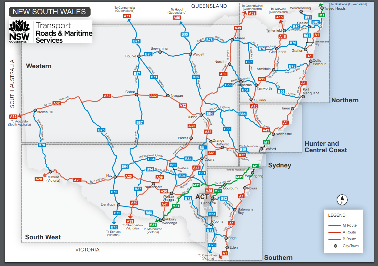
This layer depicts hurricane evacuation routes and risk areas as designated by the Federal Emergency Management Administration (FEMA).Hurricane evacuation zones categorized for zip codes coded for four separate zones: A, B, C, & Coastal.
This API provides information about the operators which are contracted to Transport for NSW. It provides the route and service by Operator. This data is also considered a master (reference) list of transport routes and lines. The data is based on the Transport for NSW Contract Management Route Services and includes route lookup, operator contact details, operator Twitter handles, colours and icons.