OwnerNational Renewable Energy Laboratory (NREL) - view all
Update frequencyunknown
Last updatedabout 1 year ago
Format
OverviewIETcalderadavenportdrillingegsexplorationgeothermalhydrothermallocationmapmapsnewberryoregonpermitsseismicvolcanowellwell location
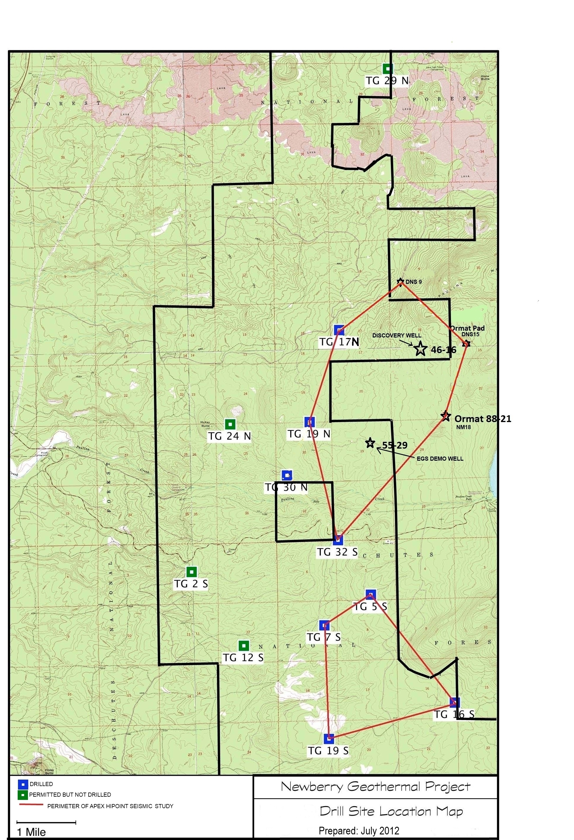
A map showing location of wells permitted, drilled and seismic test, as part of validation of innovative exploration technologies done for the Newberry Volcano project in 2012.
Additional Information
KeyValue
dcat_issued2012-07-01T06:00:00Z
dcat_modified2019-11-14T23:17:30Z
dcat_publisher_nameDavenport Newberry Holdings, LLC
guidhttps://data.openei.org/submissions/3001
ib1_trust_framework[]
language
Files
- JPEGDrill Site Location Map.jpg