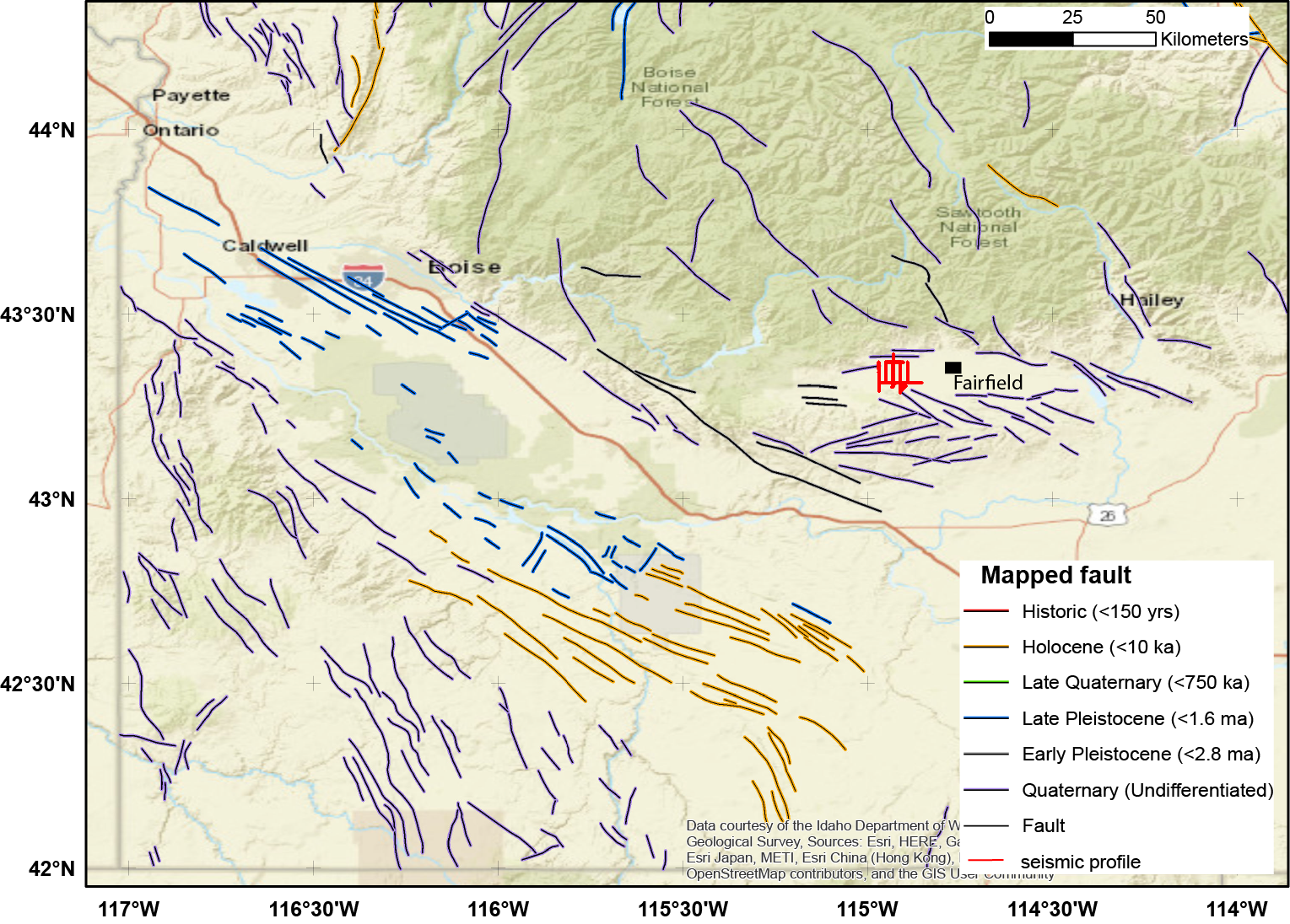
This archive contains seismic shot field records for 10 profiles located in Camas Prairie, Idaho. The eight numbered .sgy files were acquired using a seismic land streamer system with an accelerated weight drop source and 72 geophones. These 10-Hz geophones were mounted on base plates and dragged behind the seismic source. Shots were acquired every 4 meters along the length of lines 500West, 550 West, 600West, 700West, 800West, 900West, 200South and 200North. The objective was to map stratigraphy and structures related to geothermal fluid flow in the upper few hundred meters. A readme file is included with descriptions of individual files. The lines names refer to to roads which are numbered relative to the distance from the county seat (the town of Fairfield) along the the main highways. For example, 500 West implies that this north-south street crosses the main road 5 miles to the west of town. The included geologic, topographic, and aerial maps show the labeled seismic lines, while the regional map shows only the line geometry and regional faulting.
- PDFCamas_200N_migrated_depth.pdf
- PDFBarron_depth.pdf
- PDFBakstrum_depth.pdf
- PDFCamas_200S_migrated_depth.pdf
- PDFLandStreamer_9000_500West_composite_seismic.pdf
- XLSXCamas_Seismic_Master.xlsx
- PDFIdaho_Camas_seismic_geol.pdf
- PDFIdaho_Camas_seismic_aerial.pdf
- PDFIdaho_Camas_geol_topo.pdf
- sgy550West_shots_geom.sgy
- sgyBakstrum_shots_geom.sgy
- sgyBarron_shots_geom.sgy
- sgy200North_shots_geom.sgy
- sgy800West_shots_geom.sgy
- sgy500West_shots_geom.sgy
- sgy600West_shots_geom.sgy
- sgy200South_shots_geom.sgy
- sgy700West_shots_geom.sgy
- sgy900West_shots_geom.sgy
- PNGIdaho_Camas_Seismic_Regional_map.png
- TXTReadMe.txt